Chair for Global Urbanization and Remote Sensing
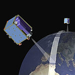
The focus of the CAIDAS-related professorship is on global urbanization and risk research using predominantly remote sensing data. Nowadays satellites generate enormous amounts of data. The Space News magazine titled a few years ago with the question: „The coming data tsunami: a gathering tide of satellite imagery is headed our way – are we ready?“. To be ready for this gathering tide of satellite imagery, most modern methods of data science are crucial. Big data remote sensing analysis in combination with domain specific urban geographic research holds enormous potential to assess the condition and changes to the earth's surface and atmosphere. Thus, the integration into CAIDAS aims to create synergies between information technology solutions and domain-specific urban applications.
The professorship cooperates closely with the DLR (German Aerospace Center).
Prof. Dr. Hannes Taubenböck
Deutsches Fernerkundungsdatenzentrum (DFD)
Münchner Straße 20
82234 Wessling
&
Universität Würzburg
Lehrstuhl für Globale Urbanisierung und Fernerkundung
John-Skilton-Str. 4a